 |
 |
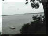
Clay's
Point on the James
River.
Cook Photo 2001 |
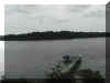
Looking
towards Wyanoke from Clay's
Point (1635)
Cook Photo 2001 |
|
|
 |
 |
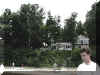
Bluff
from the Dock.
Cook Photo 2001 |
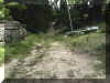
The
old Colonial Road at the Clay
property.
Cook Photo 2001 |
|
|
|
|
 |
 |
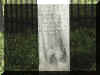
Henry
Clay, the elder's tombstone
Cook Photo 2001 |
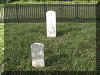
Head
and foot stones of Henry Clay,
the elder.
Cook Photo 2001 |
|
|
|
|
 |
|
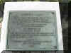
Plaque
clarifying statement on the
original tombstone.
Cook Photo 2001 |
|
|
|
|
|
|
|